|
|
TOPO! cd-roms
"Explore the outdoors with award-winning TOPO! Map Software. Each CD-ROM features seamless statewide coverage from USGS maps. Design, customize, and print your own topographic maps. Trails profiles make it easy to visualize your hike. 3-D relief shading can be turned off or on, bringing each map alive. The 1:24,000 scale provides exceptional detail, perfect for outdoor enthusiasts"...by National Geographic
|
 |
Wisconsin/Illinois/U.P. of Michigan
|

SCREENSHOT

SCREENSHOT
TOPO! State - Outdoor Recreation Mapping SoftwareTOPO! features five layers of the best maps available - from National Geographic Atlas maps to the most detailed USGS topographic maps. Loaded with features and functionality, TOPO! is essential gear for your outdoor recreation activities.
FEATURES:
Seamless 1:24,000 and 1:100,000 scale USGS topographic maps
Both PC and Mac compatible
3D Views and fly-thrus
GPS Ready - transfer waypoints and routes between the software and your GPS. Note: Waypoints and routes will be transferred to your GPS unit, but maps cannot be transferred or viewed on your GPS.
Updated street overlay that can be toggled on/off
Elevation profiling - draw a route and automatically generate a profile showing elevation gain/loss and distance
Live Map Update - search for updated USGS quads in your area and download them quickly
Add your own notes, symbols, photos, and web links to the maps
Print customized, high-quality, easy-to-read maps. Use Adventure Paper for the option of printing on waterproof, tear-resistant paper on your inkjet printer.
Choose from lat/long or UTM grids
Use the USA Place Finder to search over 1 million campsites, lakes, summits, and campgrounds
Download custom map overlays and swap files with other TOPO! users on the National Geographic mapXchange website
Minimum System Requirements:
Windows: 95, 98, ME, 2000, XP, NT 4.0 and higher. Works with all color and black & white printers supported by these operating systems.
Macintosh: OS 10.2 or above. Works with all color and black & white printers supported by Mac OS 10.
|
| 
|
STREET ATLAS USA Plus 2007 on DVD-rom
by DeLorme |
|
Ideal for Laptops, Desktops, PDAs, iPods, and GPS
More powerful than online mapping. Comprehensive tools for traveling using the latest gadgets
Authentic DeLorme Maps
Not licensed from 3rd party companies, the updated maps and 4 million places of interest are produced by experienced mapmakers at DeLorme,
The GPS Leader
Advanced and Practical
Everything in the regular version plus extensive data import capability, 120 million U.S. and Canadian phone listings, and higher-end print and draw tools. Updated U.S. and Canada street-level maps 4 million up-to-date places of interest, automatic routing, iPod static map export
powerful GPS navigation with spoken directions and voice commands
Produced by DeLorme Mapmakers
Unlike other mapping products that license from the same restrictive mapping sources, DeLorme updates, manages, & produces its own maps and 4 million places of interest
The GPS Leader
Innovative GPS features: voice commands, spoken directions, automatic back-on-track re-routing with off-route distance settings, mobile map colors, and much more
On 2 DVDs-one application & maps, one phone & address data
Minimum System Requirements:
Windows
» Microsoft® Windows® 2000 (Service Pack 3 and higher) with 64 MB RAM (256 MB recommended)
» Microsoft Windows XP (Service Pack 1 and later) with 128 MB RAM (256 MB recommended)
Macintosh
» Compatible with Intel-based Macintosh computers running Boot Camp for Windows XP
Palm OS
» Palm OS® 3.5 or later, including Palm OS 5.0 or later devices with high-density displays (spoken prompts available on most devices with Palm OS 5.2 or later)
» Application memory required: 700 KB (without spoken prompts) or 1.3 MB (with spoken prompts)
» Map memory required: 2 MB
Windows CE
» Windows Mobile 2003, Windows Mobile 5.0, and later with an ARM processor and a touch screen (including the portrait,landscape, and high-resolution configurations of Windows Mobile 2003 Second Edition and later)
» Application memory required: 1.6 MB
» Map memory required: 2 MB
» Note: The Motorola Q and other SmartPhones without a touchscreen are not supported.
Hardware
» Intel® Pentium 300 MHz or higher processor (600 MHZ recommended)
» DVD-ROM Drive
Internet Browser
» Microsoft Internet Explorer 5.01 or later
See DeLorme.com for more detail
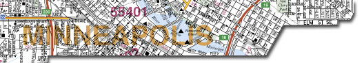
SAMPLE MAPS
|
|
 |
|

View Cart |
|
• Home •
Twin City Street Atlases • Twin City Area Folding Maps • Twin City Giant Wall Map
Twin City 50 Mile Radius • Twin City 100 Mile Radius
Milwaukee Metro Street Atlas • Milwaukee Area Map • Waukesha Area Maps
Minnesota
Highway Map • Wisconsin Highway Map
State Zip Code Maps • DeLorme
Atlases • Upper Midwest
Globes • Foreign Maps
World Maps • U.S. Maps
State Highway Maps • U.S. City Maps • TOPO! Software
Map Pins & Flags • Magnifiers • Booklights
Custom
Services • About Us • Contact • About
Buying Online
• Home •
Hudson Map Company
2510 Nicollet Avenue
Minneapolis, MN 55404
tel: 612-872-8818
fax: 612-872-1855
Hours: Monday-Thursday 9-4
  
|